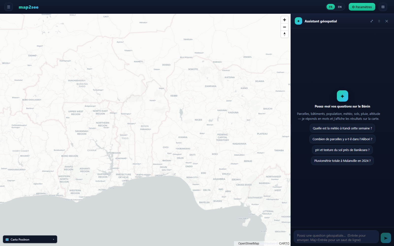
map2see in action, the interactive map of Benin with the built-in natural-language geospatial assistant.
An open-source agricultural Geographic Information System, deployed in Benin. map2see turns open satellite data into an interactive map of the country's farmland (land cover, field boundaries, crop types and vegetation health), all without any proprietary data.
Deployed in Benin · Private deployment
map2see in action, the interactive map of Benin with the built-in natural-language geospatial assistant.
Reliable agricultural data is scarce across much of Africa. Where a field is, what grows there, and how the crop is doing are questions that usually require expensive surveys or proprietary datasets. map2see answers them from freely available satellite imagery, giving decision-makers, researchers and agronomists an up-to-date, ground-truthed view of the landscape at national scale.
A complete pipeline from raw satellite imagery to an interactive, queryable map.
Classifies the landscape (cropland, vegetation, water, built-up) from open satellite imagery.
Automatically extracts individual field polygons, cleaned to match smallholder realities.
Assigns a crop label to each field from open agricultural datasets and satellite signals.
Tracks vegetation health field-by-field over time, revealing growth cycles, stress and seasonality.
Extruded building footprints with real heights, plus population layers for context.
Ask questions in plain language (field counts, area stats, imagery, weather) and see answers plotted on the map.
Current conditions and agronomic forecasts (rainfall, evapotranspiration) for any location.
A fast, modern web map with switchable basemaps, layer toggles and clickable features for exploration.
From open satellite archives to a living map, in three stages.
Pull open satellite imagery and geospatial datasets for a chosen region.
Delineate fields, label crops, compute vegetation indices, and store everything in a spatial database.
Visualise layers, inspect any field, and query the data in natural language through the web UI.
map2see is built primarily on public satellite archives and open datasets, no proprietary imagery and no vendor lock-in, so results can be reproduced and audited. Where appropriate, local data is also incorporated to build country-specific layers and to validate the models against ground truth.
map2see is currently deployed for Benin as a private deployment. Because it is built entirely on globally available open datasets, the exact same pipeline can be pointed at any area of interest (a district, a region, or an entire country) anywhere in the world.
The underlying datasets span the whole planet, any nation can be onboarded without new data sources.
Define an area of interest and run the same ingest and processing steps to generate a full national map.
Free open data and open-source tooling keep deployment affordable for governments and institutions.